

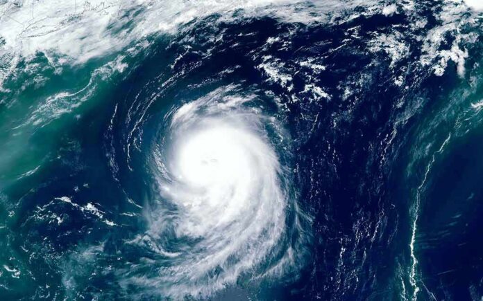
Hurricane Isaias is strengthening in the Gulf and is forecast to intensify further before striking the U.S. northern Gulf Coast late Friday or early Saturday.
Story Highlights
- National Hurricane Center says Isaias has 80 mph winds and is expected to strengthen before U.S. landfall.
- Forecast calls for near-major intensity in 24 hours as the storm heads for the northern Gulf Coast.
- Hurricane and storm surge warnings are posted across parts of Mississippi, Alabama, and Florida.
- Track guidance points to landfall late Friday or early Saturday within the warning area.
NHC Confirms Strengthening, Warns of More Intensification
National Hurricane Center forecasters reported Thursday that Hurricane Isaias had maximum sustained winds near 80 miles per hour with higher gusts. Forecasters said additional strengthening is expected through early Friday, and the storm should remain a strong hurricane as it approaches the northern Gulf Coast on Friday. The forecast discussion added that significant intensification is likely in the short term, with the storm projected to reach just below major hurricane strength in 24 hours if conditions hold.
Forecasters tied the warning to a clear track. On the current path, Isaias should pass to the north of the Yucatan Peninsula today and then move toward a U.S. landfall late Friday or early Saturday within the warning area along the northern Gulf Coast. The National Hurricane Center stressed that wind, storm surge, and rainfall threats will expand well away from the center, so communities near and east of the track should finish preparations today.
Warnings Along the Northern Gulf Coast
The National Weather Service and National Hurricane Center issued hurricane warnings from parts of coastal Mississippi eastward into the Florida Panhandle, along with storm surge warnings from the Mouth of the Mississippi River to points along Florida’s Big Bend. These warnings reflect the expected strengthening and the growing surge risk along shallow, vulnerable shorelines. Officials urged residents in warning zones to follow local orders, secure property, and be ready for power outages and inland flooding.
Emergency managers along the Gulf have moved resources into place. Local agencies are staging high-water vehicles and rescue teams. Utility crews are pre-positioning to restore power once winds drop to safe levels. Coastal communities prone to surge and barrier islands face the greatest immediate risk. Low-lying areas near bays and inlets could see rapid water rises as onshore flow builds into Friday night, even before the center comes ashore.
What The Forecast Means For Families, Fuel, And Roads
Gulf families should plan for strong winds, heavy rain, and possible tornadoes on the storm’s east side. Drivers should expect road closures where surge and flash flooding occur. Fuel demand often jumps ahead of landfall, and ports and offshore platforms can pause operations for safety. Those steps protect people and equipment and help speed recovery once the storm passes. Finish yard work now, charge phones, and have food, water, medicines, and a simple first-aid kit ready.
Homeowners should clear gutters, secure outdoor items, and check generators in open, ventilated areas only. Boat owners should move vessels to safer moorings or add extra lines. Pet owners should stock food and keep carriers handy in case of a quick move. If local officials issue evacuation orders for surge zones, leave early to avoid night travel. Keep a printed map in case mobile service goes down. These simple steps cut risk and help first responders focus on the most urgent calls.
How Forecasters Judge Intensity And Why It Matters
National Hurricane Center specialists base intensity on aircraft data, satellite trends, and surface reports, then update advisories every few hours. The center’s forecast discussion on Thursday outlined confidence in short-term strengthening and called for near-major intensity within a day if ocean heat and wind patterns stay favorable. While forecasts always carry some uncertainty until landfall, officials design warnings to save lives, not to split hairs on exact wind at every point along the path.
🚨 HURRICANE ISAIAS — 9:30 AM ET THURSDAY UPDATE 🧵
Isaias is strengthening in the Gulf. Life-threatening surge, destructive winds, flash flooding and outages threaten the northern Gulf Coast.
Landfall: late Friday or early Saturday. 1/
— Artanis (@ArtanisCap) October 8, 2026
Verification studies explain why the message stresses preparation. The National Hurricane Center’s own records show that intensity forecasts can miss by about one category at 24 to 48 hours, even as track guidance has improved. That is why surge, rain, and wind warnings are issued with a safety margin and why residents are urged to act when watches and warnings go up, not to wait for a last-minute category number to change.
What To Do Now
Residents in hurricane and storm surge warning areas should finish preparations today and review local evacuation zones. Keep vehicles fueled, cash on hand, and important documents in a waterproof pouch. Check on elderly neighbors and family. Parents should plan for school and work closures on Friday. Stay tuned to local officials and National Weather Service updates. The window for safe action is before tropical-storm-force winds arrive along the coast later Friday.
🚨🇺🇸 Isaias is the year's first hurricane, and it is set to SLAM the Florida-Alabama line tonight.
It formed in the Gulf on Wednesday and is still aimed at that border.
It should keep strengthening until wind shear near the coast starts tearing it apart, and it is still… pic.twitter.com/MakoOBhf96
— Mario Nawfal (@MarioNawfal) October 9, 2026
Sources:
prod-east-nhc.woc.noaa.gov, nhc.noaa.gov, forecast.weather.gov, weather.gov